


01
Overview
Stormbreaker, at Microsoft Federal
Stormbreaker was a planning and wargaming tool for U.S. Indo-Pacific Command. At Microsoft Federal I designed the UI/UX and Unreal Engine work for its simulation half, built for SMX and working directly with military planners. The project had come over from Studio Alpha when that studio shut down, and I moved with it, along with the rest of the creative team and some of the engineers.
NDA notice
Due to the project being under a limited NDA, every artifact on this page has been recreated for this case study to align with the publicly available JP 5-0 documentation that planners work from. The feature focus is also narrowed down to some interaction designs and a variation of the SmartCard I brought over from Studio Alpha.
Publicly available information on the Stormbreaker project:
02
Challenge
Digitizing traditional methods
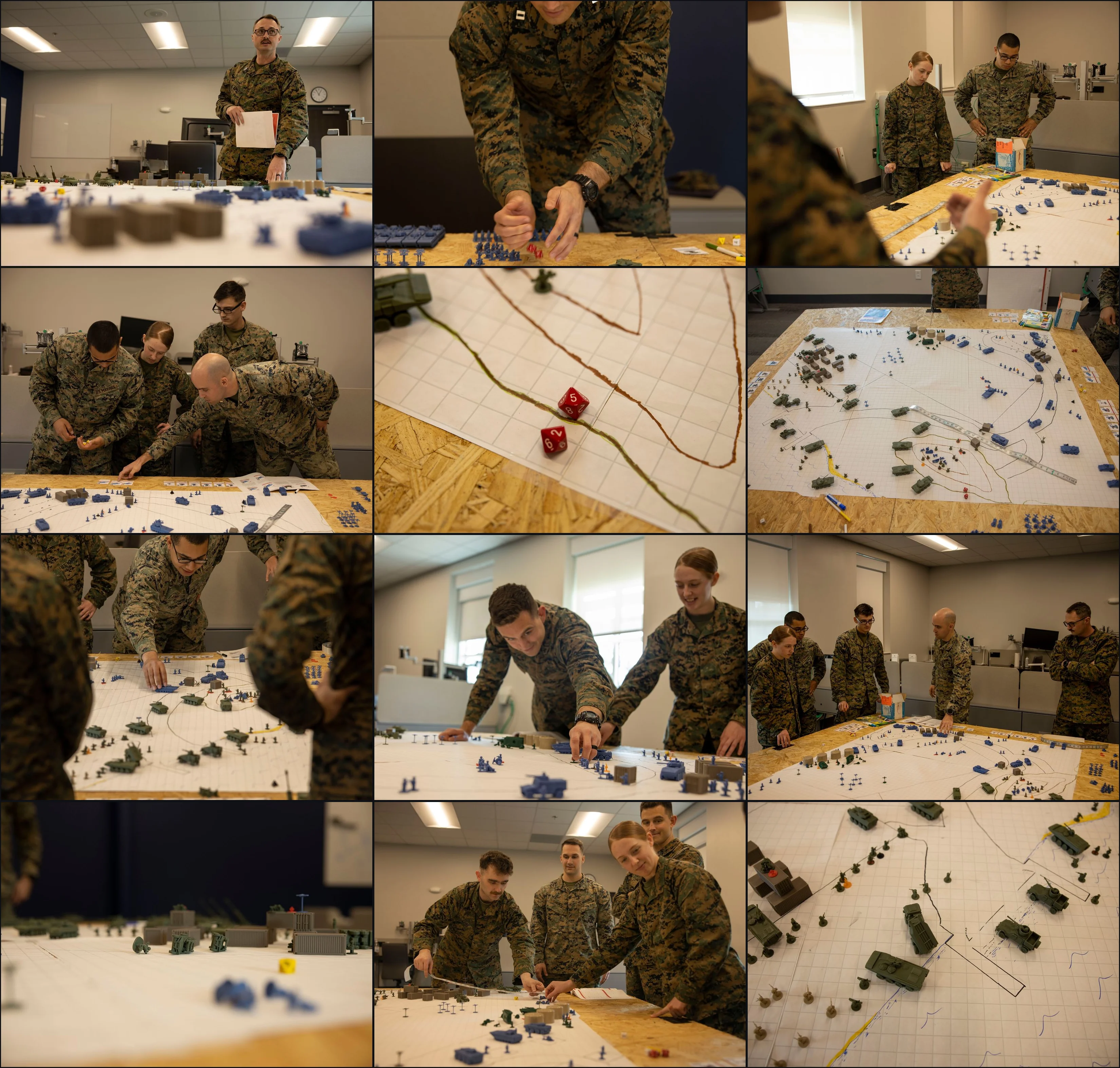
Military planners have worked with pen and paper and disconnected third-party tools for decades. The process is well established: plans are built in PowerPoint, presented in PowerPoint, then printed and stored in binders on a shelf. That makes reviewing, cataloging, and referencing past plans harder than it needs to be, and wargaming one could take upwards of 16 months to organize and run. Stormbreaker's goal was to digitize the JP 5-0 process and drastically streamline the whole experience.
03
Process
Bringing the SmartCard over
These are mockups of proposed solutions, validated either internally during exploration or directly with customers.
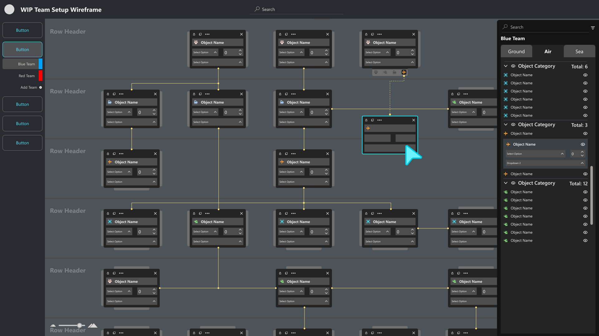
The SmartCard came over from Studio Alpha: a customizable, data-driven card carrying the information relevant to the plan being built, drawn from what the planner had already set up in earlier steps.
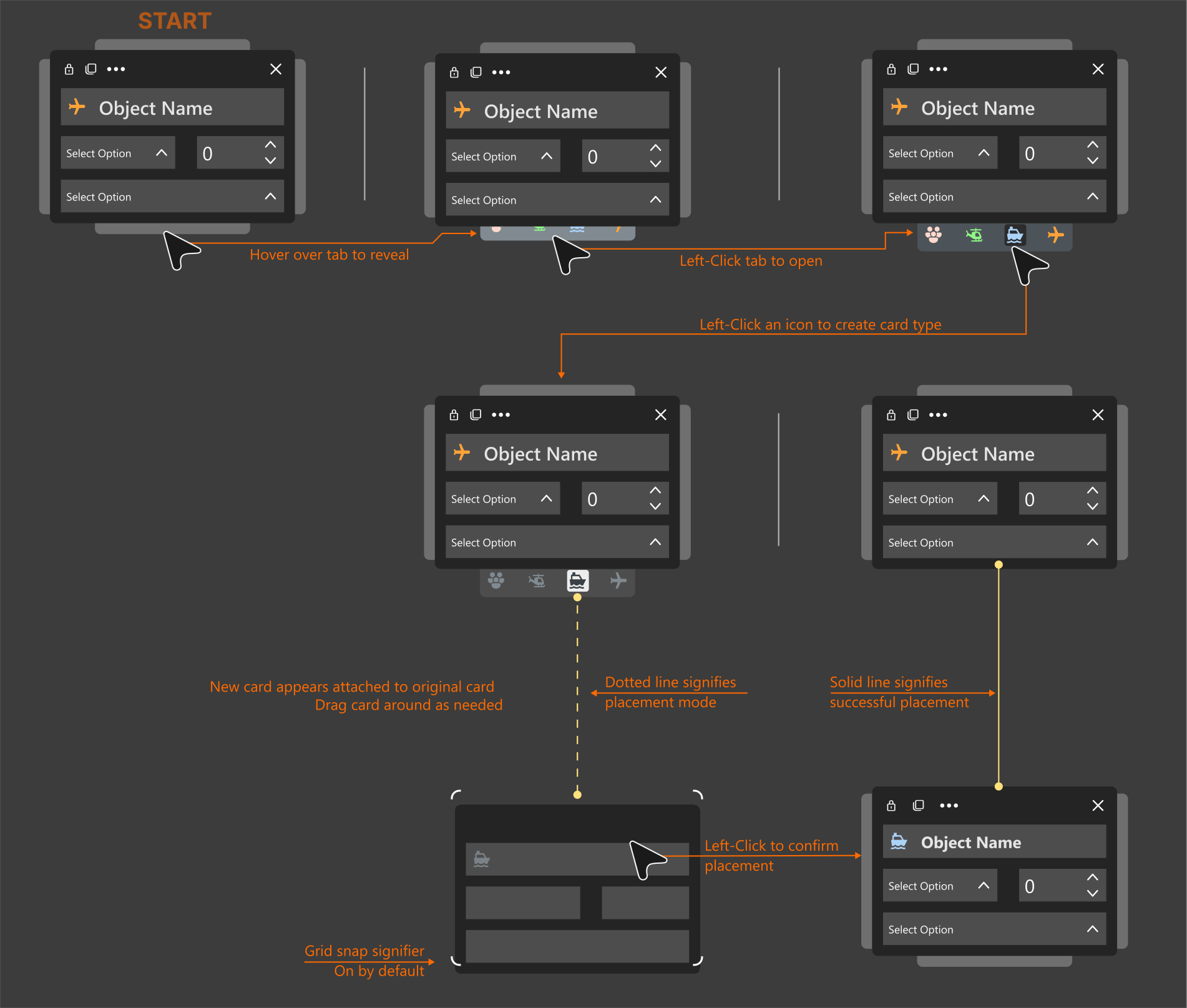
A planner could drop one SmartCard onto the grid and build a hierarchy of objects from it. The card offers the correct object types depending on which side tab is used. Each object card can be customized further if a planner needs more or less data.
SmartCard design
Custom operational areas
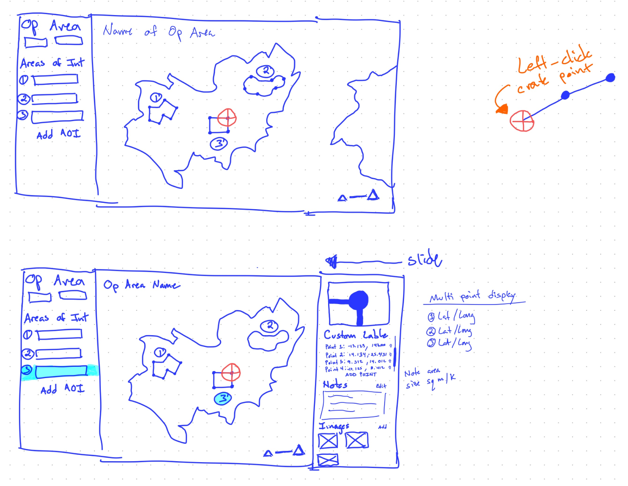
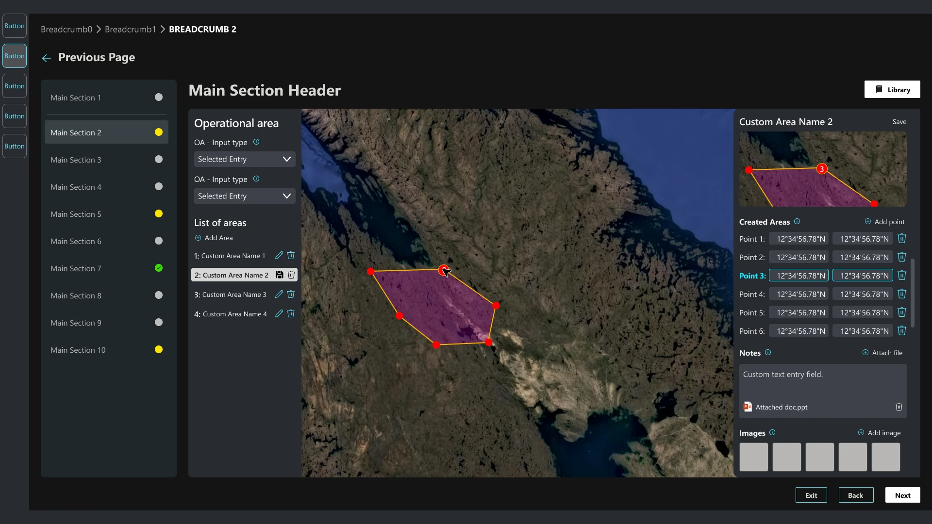
Custom areas were something planners kept raising, so the work started on a napkin while a customer talked me through how they do it now and what they wished they could do instead.
SmartCard creation prototype
This interactive Figma prototype creates two SmartCards. The first is created vertically, below the existing card; the second horizontally, to its right. The point of a prototype like this was to demo the interaction to potential users and get their feedback. This version carries a text hint to give direction from the start.
Best viewed full screen. It doesn't work on mobile at the moment, since the interaction relies on hover.
Drag & place object groups
Placing objects is the main action when setting up a scenario, and these objects usually come in groups. The motion study below shows a group of objects being placed at once from the left nav, after which one single object can be selected and moved independently.
Embedding objects
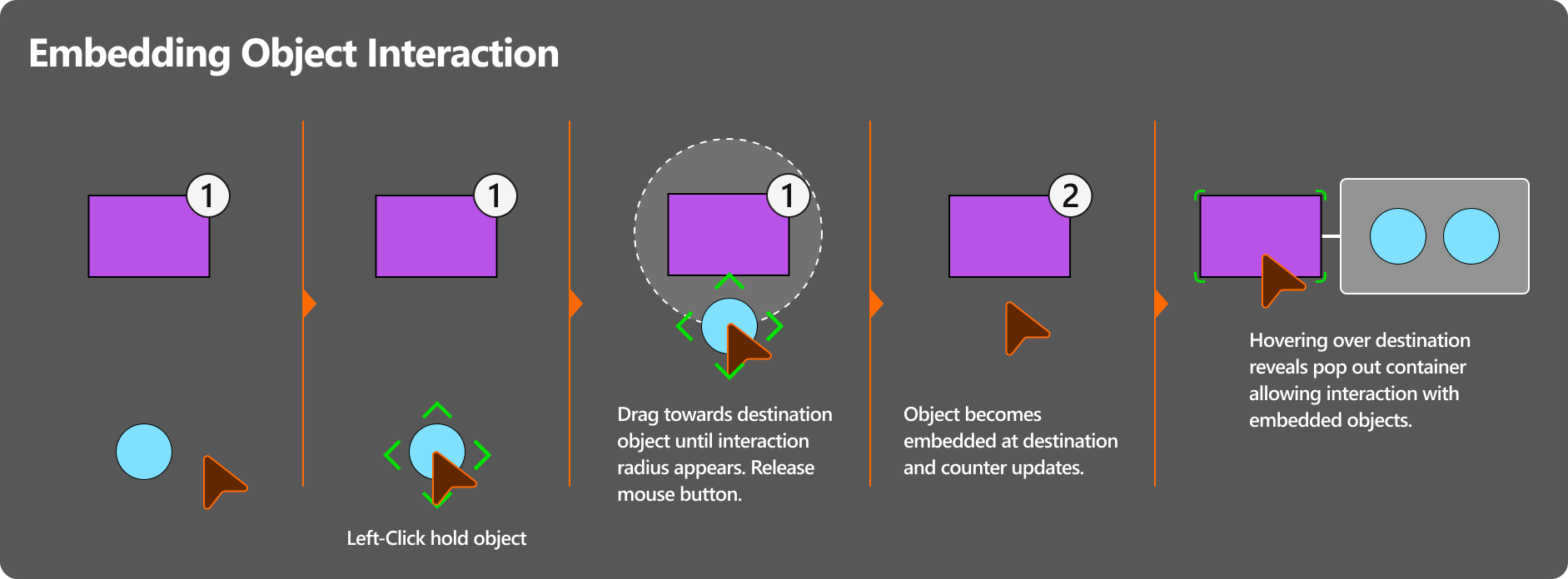
Embedding objects into other objects was something planners would do countless times throughout the creation and testing of a plan. On a map holding hundreds or thousands of objects, selecting one or more and embedding them into a location had to be painless and intuitive. Locations holding embedded objects show the count in a signifier at the corner, and hovering over a location pops up a window listing everything inside, for quick access.
04
Outcome
What came next
SMX, who had contracted the work to Studio Alpha and then to Microsoft Federal, brought Stormbreaker entirely in house, which ended my contract through Allovus along with the rest of the team's. About a month later, the former Studio Alpha director, by then SMX's project director for Stormbreaker, hired me and the other two designers to continue the work, and the designs from this phase carried into the SMX build.